Intro to Digital Mapping for Permaculture Land Management
September 14th 10am – 4pm
With Liam at CERES Community Environment Park
Roberts Street, Brunswick East
Join us as we explore the incredible potential of digital mapping in planning for sustainable land management and permaculture systems
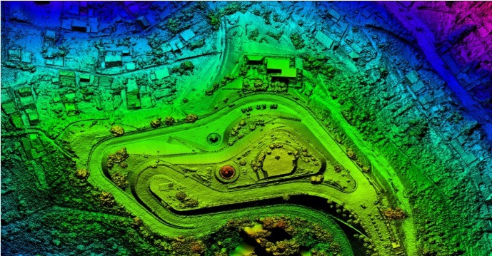
The use of ‘Geographic Information Systems’ (GIS) is exploding across the world. Enabled by geo-referenced data, users are able to visualise vast amounts of information to access new insights about the surface of the Earth and the interconnecting systems that underlie everything.
In this introductory workshop we will cover:
-real world examples
-free and open source software available in this field
-sourcing data and opening it in our software
-visualisation and interrogation of data
-exporting our visualisations to Google Earth for sharing and collaboration
-examples and practice at further data analysis as time allows (this may include catchment analysis, slope and aspect analysis, viewsheds, construction of 3D landscape models etc)
This workshop is suitable for beginners, and we will be using a collaborative classroom model.
This workshop will be digitally focused and participants will get the most out of it if they bring their own laptop with the following free software pre-installed:
QGIS 3.8.1 ‘Zanzibar’
Google Earth Pro
Liam has obtained a Masters in Geospatial Information from RMIT, has trained in Edible Forest Garden Design with Dave Jacke, Permaculture Design with Moonrise Permaculture and the Perma Pixie, Advanced Permaculture Design for Climate Resilience with Oregon State University, and has a Bachelor of Science and a Bachelor of Environmental Science from the University of Newcastle.
Cost is $150 with concession $100
Includes Lunch & Afternoon tea.
Bookings https://www.facebook.com/events/763838977366544/